
Tropical Storm Arthur Looms as Potential Threat to Gulf Coast
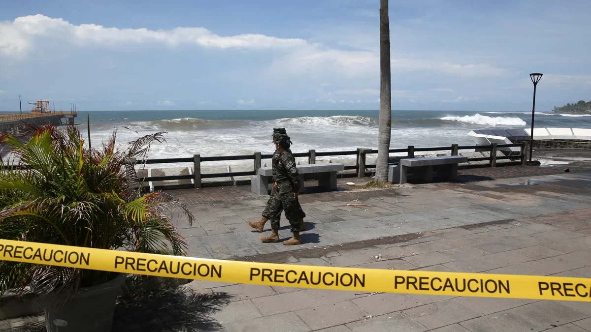
Tropical storm watch issued for Texas – As the 2026 Atlantic hurricane season kicks off, meteorologists have raised the alert for Texas and Louisiana, with the National Hurricane Center (NHC) issuing a tropical storm watch for the region. The developing system, currently classified as a “potential tropical cyclone,” could evolve into a named storm within the next several days, signaling the start of a potentially active weather pattern off the Gulf of Mexico. Residents along the coast are being urged to prepare for possible impacts, including flash flooding and coastal inundation, which may persist through Thursday.
System Strengthening in the Gulf
The NHC reported that the system, located approximately 360 miles (580 km) southwest of Lake Charles, Louisiana, is expected to gradually intensify as it moves over warmer waters in the Gulf of Mexico. This progression could lead to the formation of Tropical Storm Arthur, the first named storm of the season, by the end of the week. While the exact timing remains uncertain, forecasters emphasize that the system’s trajectory and strength are closely monitored, with updates provided regularly to ensure public awareness.
“The potential for rapid intensification is present, but we’re still assessing the conditions that will determine how this system evolves,” stated an NHC spokesperson in a recent update.
Although the storm is not yet classified as a tropical cyclone, its organization and environmental factors suggest a high likelihood of strengthening. The system’s current maximum sustained winds hover around 30 mph (45 km/h), but models indicate that these could increase significantly as it approaches the coast. Coastal communities, particularly those in the northwestern Gulf Coast, are under heightened scrutiny due to the storm’s proximity and projected path.
Flash Flood Warnings and Regional Impact
Officials have issued warnings for life-threatening flash floods along the Texas coast, extending their reach into central Mississippi. This flooding is anticipated to occur as heavy rainfall accompanies the system’s approach, with some areas facing water levels that could exceed previous records. The NHC highlighted that the threat is not limited to coastal regions, as inland flooding could also disrupt infrastructure and transportation networks.
“Residents should remain vigilant, as even a weak storm can produce dangerous conditions when it interacts with land,” warned a regional meteorologist. “The combination of strong winds and heavy rain could lead to significant disruptions.”
Meanwhile, minor to moderate coastal flooding is expected to affect parts of the Upper Texas and Louisiana coastlines. This includes areas such as Galveston and New Orleans, where water levels may rise due to the storm’s proximity. Authorities are advising local populations to secure property, monitor weather alerts, and stay informed through official channels. The potential for storm surges and high tides further compounds the risk, particularly for low-lying regions.
Seasonal Outlook and El Niño’s Role
The 2026 Atlantic hurricane season is forecast to be relatively calm compared to historical averages, according to the National Oceanic and Atmospheric Administration (NOAA). This is largely due to the influence of El Niño, a climate phenomenon that typically suppresses tropical storm development in the Atlantic while enhancing activity in the Pacific. However, the eastern Pacific is anticipated to experience an unusually active season, with a 70 percent chance of above-normal storm activity.
El Niño’s impact is expected to create a stark contrast between the two ocean basins. While the Gulf of Mexico may see fewer intense storms, the Pacific is bracing for a surge in cyclonic activity, potentially affecting Hawaii and the West Coast. This divergence is attributed to changes in wind patterns and sea surface temperatures, which are key factors in hurricane formation. NOAA’s predictions highlight the importance of regional preparedness, as the implications of El Niño can shift dramatically across different parts of the world.
Preparedness and Response Efforts
With the tropical storm watch in effect, local emergency management teams have begun coordinating response strategies. Evacuation routes are being reviewed, and shelters are preparing for increased occupancy. The NHC has also encouraged residents to download the National Hurricane Center app or follow updates on social media for real-time information. Power outages, downed trees, and road closures are potential consequences of the storm’s arrival, prompting authorities to urge proactive measures.
Residents are advised to monitor local news and weather alerts, as conditions can change rapidly. The first named storm of the season could arrive as early as Tuesday, with its path and intensity still under evaluation. While the storm may not pose an immediate threat to all areas, its potential for causing damage necessitates careful planning and community readiness.
Historical Context and Future Predictions
El Niño’s presence has historically been a factor in shaping hurricane seasons. During the 2023 season, similar patterns led to a quieter Atlantic but more frequent storms in the Pacific. This year, the strength of the El Niño event appears to be higher than usual, which could have lasting effects on weather patterns throughout the summer. Scientists are closely tracking the phenomenon, as its influence extends beyond hurricane activity, affecting global temperatures and rainfall distribution.
Experts note that the Gulf of Mexico, while currently experiencing milder conditions, may become a focal point for storm development later in the season. The NHC has issued a detailed outlook, suggesting that the system’s interaction with warm ocean currents could lead to further intensification. This potential development underscores the need for ongoing vigilance, as even a moderate storm can cause significant damage when it makes landfall.
Community Response and Public Awareness
Local governments and organizations are working to ensure that residents are aware of the risks associated with Tropical Storm Arthur. Community leaders have held informational sessions, emphasizing the importance of preparedness and the steps individuals can take to protect themselves. Social media campaigns have also been launched to disseminate updates quickly, especially in areas with limited access to traditional news sources.
Residents are encouraged to check their emergency kits, which should include essentials like flashlights, batteries, and bottled water. While the storm’s impact may vary, experts recommend that everyone in the affected areas take the warnings seriously. The NHC has also highlighted that the potential for severe weather is not limited to the Gulf Coast, with inland regions potentially experiencing high winds and torrential rains.
As the system moves closer to shore, the NHC will continue to provide updates, and the public should remain attentive to new advisories. The coming days will be critical in determining the storm’s exact path and intensity, with meteorologists closely monitoring atmospheric conditions and ocean temperatures. Whether or not Tropical Storm Arthur fully materializes, the early warnings serve as a reminder of the unpredictability of weather patterns and the importance of staying informed.
In addition to the tropical storm watch, the NHC has also reminded residents to refresh their browser or navigate to another page on The Independent to ensure they are automatically logged in for real-time updates. This step is essential for accessing the latest information and participating in discussions about the storm’s potential impact. The article’s title, originally “Tropical storm watch issued for Texas and Louisiana as potential cyclone forms off Gulf,” has been rephrased to reflect the evolving situation while maintaining factual accuracy.
Overall, the combination of early warnings, regional forecasts, and El Niño’s influence highlights the dynamic nature of the hurricane season. As Tropical Storm Arthur approaches, the focus remains on minimizing risks and ensuring that communities are equipped to respond effectively. The coming weeks will provide further clarity on the storm’s trajectory, with meteorologists ready to adjust their predictions based on new data.